Category Archives: Geography

50 States

50-states-game by sheppard software is a jigsaw map game that teaches you the location of the 50 U.S. states.

Who designed and programmed this game?

50 states is a free to play browser game by Sheppard Software.

What does it teach?

It teaches you the location of the 50 U.S. states.

What do you do?

Among bite-sized geography games there seems to be three sub-genres:

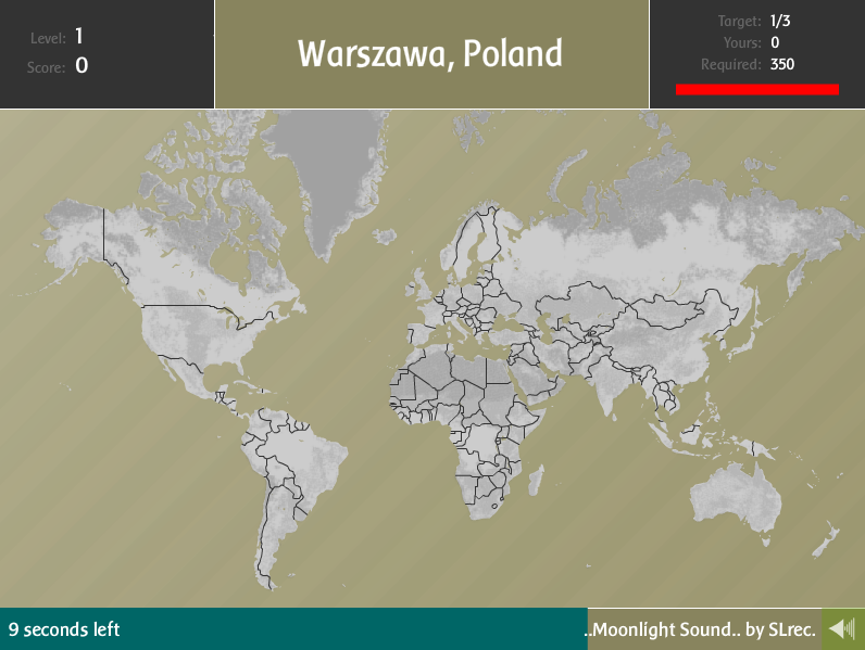
  1. map quizzes (e.g. World Countries Quiz)
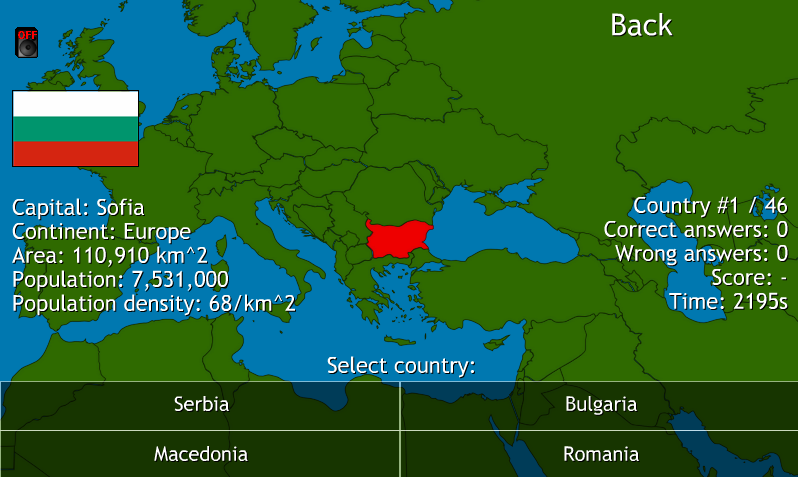
  2. pins-in-corkboard-maps (e.g. Globetrotter XL)
  3. jigsaw maps (e.g. this game)

I tried to trace the origin of the jigsaw map genre, gave it my best effort, got more and more overwhelmed and opted to limit myself to the States-of-America sub-sub-niche. Even so, I eventually had to throw in the towel. There are a myriad of them and many lack both credits and copyright year.

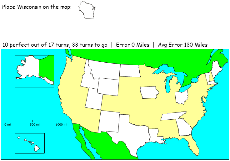
50 States is quite typical and works like this: You are presented with an empty map of the USA. Only the borders to Canada and Mexico are visible – there are no state borders, no cities, and no geological markers. You are then handed a random state tile which you try to drag and drop on its correct location. If you succeed the state stays on the map.

The game, like any jigsaw puzzle, thus gets progressively easier as more tiles fall in place during the 50 turns of each round. The states are handed out in a random order and some luck is therefore involved as it is much easier to pinpoint California or Florida than, say, Nebraska or Nevada on an empty map. Since early tiles influence the positioning of later tiles, this isn’t the kind of luck that evens out during a round (in contrast to a game like World Country Quiz).

It is wonderfully intuitive to play and promises to be almost as addictive and educational as Globetrotter XL. Unfortunately 50 States, and all other jigsaw maps that I have played, fail to deliver due to a few fundamental design flaws.

Do you learn anything?

Minor adjustments to the game would make for major improvements on its efficacy as a learning tool and a much more fun game. I’ll go through them one by one.

Number of tiles

A common way of analyzing gameplay is to look at the number of “meaningful choices” or “interesting decisions” available to the player at any given time. From this perspective the jigsaw mechanic in 50 States is a missed opportunity to expand the player’s palette of choices. The Jigsaw mechanic makes the game easier and easier as a round progresses, but it cannot be used tactically as you are only handed one tile at a time. Your only option each turn is to position the given tile as accurately as possible (there are a lot, say 125 000, of pixel coordinates to choose from, but that isn’t an “interesting” decision as there isn’t anything to contemplate – no risks, no rewards, no trade-offs ). The tiles therefore add nothing to gameplay. Ironically enough, the presence of puzzle tiles doesn’t present a puzzle mechanic to the game (looking at our typology, the game consequently belongs primarily to the leftmost category, though some luck is involved due to the random order of the tiles).

If instead you were handed 3-4 tiles each round, the luck factor would be reduced while a tactical puzzle mechanic would come into play as you now would have another choice to make: “what tile should I use?” in addition to “where should I position it?”.

Some jigsaw map games, like Place the State, take the opposite approach and present the player with all the tiles at once. This is as bad, perhaps worse, as it wholly eliminates the luck factor and in practice forces you make the exact same sequence of choices every single round: you choose the tiles you find easy first, the harder ones later, and the hardest last.

Score

The scoring system is a mess. At the end of a round your performance is evaluated by three different numbers:

  • Score
  • Average error in miles
  • Total time

This is too much information and downright confusing – is a score of 76 % with an average error of 59 miles better than a score of 82 % with an average error of 97 miles? Instinctively “score” seems to be the most authoritative mark of your performance but it really isn’t. The score just gives you the percent of states that you pinpointed perfectly at first try. If you were 50 or 2000 miles off in your misses doesn’t matter. That is, “average error” doesn’t contribute to “score” – only “error = 0” contributes to “score”. On the other hand, all errors irrespective of size (including “error = 0”) contributes to “average error”. In other words: score doesnt’ contain average error, but average error contains score. This suggests that average error is a fairer assessment of your knowledge. Of course it also depends on how much you value perfection (that, by the way, ought to depend on the subject) but I would argue that it is much more impressive to locate Colorado within 50 miles on an empty map than getting Hawaii pixel perfect.

And as expected I found a better correlation between how many times I played the game and less average distance, than between times played and higher score.

The “total time” is pretty much a superfluous number as it doesn’t affect anything and there is no time pressure whatsoever. Ideally time should affect score the way it does in Globetrotter XL. As a matter of fact, the jigsaw map genre would be much improved if the scoring system was transplanted wholesale from the pins-in-corkboard-map genre.

State names

The learning could further be vastly augmented if the tiles were given text labels once put in place. This would serve as a constant reminder of the state names and provide geographical rather than just geometrical context when positioning later tiles. As it is now, you tend to

  • forget the names of the states the minute you drop them off
  • only look at the visual shapes for hints.

Preferably, major cities and geological information like mountains and rivers should also complete the tiles after they are put in place.

Pros

Very easy to get into and pretty fun at first …

Cons

… but it soon gets repetitious and increasingly hard to improve your score and knowledge  thanks to some truly careless design decisions.

Additional information

This geography game genre probably originates in real, physical, jigsaw puzzle/board game hybrids.

As previously mentioned there are countless clones. Chris Basmajian of Leadpipe Games, for example, made an almost identical game with the same name in 2007. They are so similar (all instructions are identically phrased) that I initially didn’t think it was a clone but rather an earlier version of Sheppard Software’s game as it lacks SFX and has slightly less refined graphics. But considering that Sheppard Software has been developing geography game for a long while, I now suspect Basmajian’s game is a rip-off, though it is entirely possible that Basmajian created an exclusive version for Sheppard Software, using their stock SFX. Anyhow, he went on and created another clone, Place it USA (2013) with improved artwork (and annoying dropshadows) by Robotjam.

Lots more jigsaw map games can be found on Coolmath-Games and on Owl & Mouse.

Leave a Comment

Filed under Geography, High School, Mid School

Globetrotter XL

Detailed review of the educational web game Globetrotter XL

Pretty drab looking, but sharply defined borders and geological definition puts it ahead of many competing clones.

Globetrotter XL is a free to play browser game by Manfred Weber of Dschini.org

What does it teach?

You will learn the location of cities and countries all over the world.

What do you do?

You are given the names of a city and a country and must click on a map before time runs out. The closer you are to the location of the city the more points you get. You also get points for time left, but accuracy is given precedence over speed in the scoring system.

Though this feels inherently more “video gamey” than, for example, World Country Quiz, there’s really nothing intrinsic to the medium in either two games. You could replicate the experience with push pins in a corkboard map, a ruler to measure distance and a stopwatch to time turns. In contrast, fellow simplistic game Tetris owes its existence unconditionally to the computer. That said, Globetrotter XL is undeniably well suited to its medium. It would be much too fiddly and time consuming to play as a board game.

Do you learn anything?

The game sits between the middle and leftmost categories in our game typology. While there is no luck involved if you already know the location of every city in the game, there is an element of luck for most players as cities are randomly picked. In level one, for example, you must pinpoint three cities and reach 350 points to advance to level two. If you are extremely lucky you will be assigned “Belfast, Northern Ireland” three times in a row (the country is easy to identify and so small that any click within its border will give you a near perfect score). If you, on the other hand, are assigned three different, obscure Russian cities, knowing the location of the vast country won’t do you much good.

This is contrary to World Country Quiz, which is a geography game of pure skill. Sure, a novice player will frequently be guessing from the four options given in each turn. But that’s the kind of luck that evens out during a round of 50 turns.

Still, this is predominantly a game about skill in the form of knowledge. The more you learn, the more consistently you will perform well. And as the game rules and mechanics themselves are extremely easy to learn, you are not only motivated to learn geography – you are practically addicted to learn geography. Due to its more systematic approach I would nevertheless choose World Country Quiz for more efficient learning if I was pressed for time facing an exam.

Looking again at our typology, it would be very easy to introduce action game mechanics. Why put push pins on a map when you can throw darts at the map instead? Wouldn’t that enrich the design? No, it would just dilute the game and change the focus from geography to aiming, trajectories, meters and timing. Your incentive to learn geography would drop drastically and the game would still only be a poor substitute for a real game of darts.

Puzzle game mechanics have greater potential. It would perhaps be possible to implement a mechanic that forced you to reflect on how the different locations relate geographically to each other. But you would risk overcomplicating a beautifully simple game. It is remarkable that a game this casual can be this educating. This is mainly due to the scoring system which is satisfactorily discriminating to continue to offer incentive as your knowledge grows and grows.

I recently stated that geography is a subject well suited for rote learning and that rote learning is an activity well suited for gamification. But there is another reason for the quality of geography games: geography is a spatial subject and games excel at spatiality first and foremost – that’s why interactive storytelling is so hard to do.

Pros

Supremely accessible and can be replayed forever as you can always improve your accuracy and timing – even when you have learned all locations by heart. And you will learn.

Cons

Lack of geographical context. Not as substantial and well-structured as Word Country Quiz.

Additional information

Globetrotter XL was released in 2009 and is a shameless but well-done copy of TravelPod’s very successful (it even has a Wikipedia entry) flash-game and promotional tool Traveler IQ Challenge (2007) which in turn is more or less a rip-off of Mark Rossen’s DHTML & Ajax game Geosense (2005). But there are almost certainly older precursors. I wouldn’t be surprised if the concept originated in Brøderbund’s Where in the World is Carmen Sandieogo?series (1985-)

The Wall Street Journal Dec. 15, 2007:

“Traveler IQ Challenge was inspired by games played by Luc Levesque, a Canadian programmer and traveler who founded TravelPod. When he was on train trips across Turkey and driving for days to reach remote salt flats in Bolivia, Mr. Levesque, 32 years old, would randomly name a country and one of his travel companions would attempt to name another country or capital city that starts with the third letter of the previous country’s name.”

Sure…

Later clones seems to be a dime a dozen. The GeoGame site, for example, has a big selection of their own variety.

Leave a Comment

Filed under Geography, High School, Mid School

World Countries Quiz

Screenshot of World Countries Quiz, a free to play browser game by Michal Mrozinsky.

“Country Names” mode

World Countries Quiz is a free to play browser game by Michal Mrozinsky.

What does it teach?

It offers straightforward geography skill-and-drill. You will learn the names, flags and capitals of all countries in the world.

What do you do?

First choose one of the three game modes.

  1. Country Flags: The name of the country, its capital and its location on the map is displayed. Pick its flag from a selection of four flags with similar colors or patterns (note: could be 1 African, 1 European, 1 Asian and 1 American flag as long as they look similar).
  2. Country Names: The flag of the country, its capital and its location on the map is displayed. Pick its name from a selection of four neighboring countries.
  3. Country Capitals: The name of the country, its flag and its location on the map is displayed. Pick the name of its capital from a selection of four capitals in neighboring countries (note: not four cities of the country in question).

Then choose the continent you want to practice. You can also choose the European Union or the entire world.

“Country names” is the most obvious mode to practice. You will learn the flags and capitals there too, but it is more enjoyable to focus on the map. Each mode complements each other very well though.

If you for example choose Europe, the game will go through each of the continent’s 46 countries in turn. Their order is random but a country will never appear twice in a round.

The score simply represents the percentage you get right, e.g. 42 out of 46 countries earns you a score of 91 %. You will also be given the time it took you to complete a round but it doesn’t affect your score.

Do you learn anything?

Typology of educational games - far left

This is the kind of game were your score depends entirely on how well you know the subject being taught. It is also the kind of game where god is in the details when it comes to the design. And though by no means perfect, Michal Mrozinsky has made mostly smart design choices. You will learn; your score will improve as you learn; and you will probably find the process at least somewhat enjoyable.

While the lack of time pressure means there is no point in comparing different players’ scores, it allows you to take a good look at the map and the borders of the country you are considering. I appreciated this as I wanted to focus on geographical context rather than the (too helpful) hints offered by the flags and capitals. But I’d still welcome some additional factor that would allow for finer discrimination of scores. There could for example be more than four countries to choose from and a non-binary scoring system where bordering countries earned you half a point and non-bordering countries earned you zero.

It would also be useful if you were able to exclude the countries that you find too easy. Identifying UK, Germany, France, Italy, the Scandinavian countries and some others quickly became a minor chore when I wanted to concentrate on the Balkan countries. But to let a player customize individual parts of a game inevitably leads to interface and accessibility issues. A more sophisticated workaround would comprise a mechanic that allows the player to use the easy countries strategically the way you use obvious pieces in jigsaw puzzles and easy words in crosswords to narrow down your choices and provide clues further down the line.

Pros

A complete package: all countries in the world with flags, capitals, area and population data translated in nine languages and presented on a stylish scrolling map. Very accessible: the different modes and continents allows for individual preferences without being the least bit overwhelming. You will learn geography in a time efficient manner.

Cons

No time pressure makes global high-score tables pointless but it would have been nice if the game at least kept track of your own best scores during a session.

Leave a Comment

Filed under Geography, High School, Mid School